
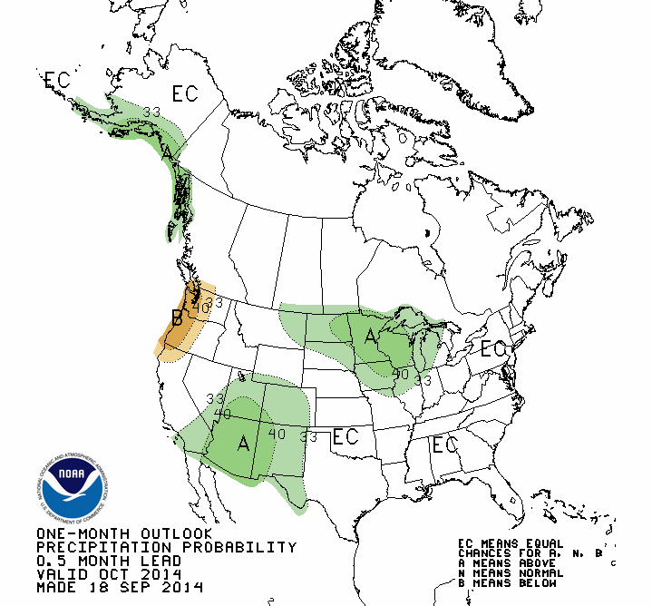
Much of the northern Corn Belt has an increased chance of above-average precipitation in October, according to the NWS Climate Prediction Center. This follows on the heels of above-average precipitation over the last 30 days across the Corn Belt.
In the map below, areas shaded in green have an increased chance of above-average precipitation in October and include the Dakotas, Minnesota, Wisconsin, Michigan, Iowa, northern Illinois, and northeast Missouri.
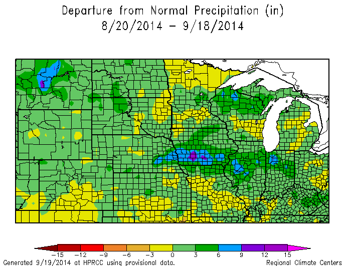
Meanwhile, in the last 30 days, above-average precipitation has fallen across the Corn Belt (areas in green in the map below). In fact, there is a band stretching from eastern Nebraska, through Iowa and Illinois, and into Indiana with amounts of 6 to 9 inches above average.
The temperature outlook for October has most of the Corn Belt in equal chances (EC) of above, below, and near-average temperatures. At least they do not show an increased chance of the below-average temperatures that have been a main feature of this growing season.
The other interesting feature of the latest NWS outlook is the increased chance of above-average temperatures expected across most of the Corn Belt for the three-month period of October-December (shown below). For the Corn Belt, there are equal chances of above, below, and near-average precipitation during this time.

You can check out the full suite of outlooks at the NWS Climate Prediction Center.

